Links to My Vacation Journals and Destinations

Looking for something in this blog?

England-Scotland Day 4 (Part 2) – Walking down the Royal Mile in Edinburgh

6 April 2010

After visiting the Edinburgh Castle in the morning and taken our lunch near Castlehill, it was time to walk down the stretch of cobbled street leading from Edinburgh Castle to the Holyrood Palace. This road is called the Royal Mile and is the heart of Scotland's historic capital. Holyrood Palace is the Queen's official residence in Scotland. Despite being crammed with tourists, this is one of Europe's best sightseeing walks.

Walking down the Royal Mile in EdinburghWe even get to see an invisible man.


Walking down the Royal Mile in EdinburghStriking red door of the St. Columba's Free Church.


St Giles Cathedral with the steeple that looks like a king’s crown.


Walking down the Royal Mile in Edinburgh

St. Giles' serves as a kind of Scottish Westminster Abbey.


Walking down the Royal Mile in EdinburghDecorative figure of a stag surrounding the statue of the Duke of Buccleuch, outside St Giles Cathedral.


Walking down the Royal Mile in EdinburghView of Scott Monument through n alleyway along Royal Mile.


Walking down the Royal Mile in EdinburghStatue of Alexander the Great taming his horse Bucephalus, outside the City Chambers.


Walking down the Royal Mile in Edinburgh

Unicorn at the top of the Mercat Cross. "Mercat” is a Scottish pronunciation of “Market”. A central meeting place where Royal proclamations and other official announcements were read.


Along the way, we made a detour to look for the statue of a dog called the Greyfriars Bobby and also made a short visit to the nearby National Museum of Scotland before it closed for the day. Dinner was at an Indian restaurant along the Royal Mile.  It was good to have Asian food again.

Then it was back to the apartment to watch Lionel Messi do his magic against Arsenal in the Champions League game.

Continue Reading »

England-Scotland Day 4 (Part 3) - Greyfriars Bobby, famous dog of Edinburgh

6 April 2010

As a dog lover, we made a special attempt to locate the statue of Greyfriars Bobby. It required a deviation from the Royal Mile, heading southwards along the George IV Bridge Road.

Greyfriars Bobby was a Skye Terrier who became known for spending 14 years guarding the grave of his owner, John Gray.  What loyalty!

Greyfriars Bobby died on January 14, 1872 and was buried in Greyfriars Kirkyard near the grave of its owner, John Gray.

A year later, this statue and fountain was erected at the southern end of the George IV Bridge to commemorate him.

Let his loyalty and devotion be a lesson to us all.

Continue Reading »

England-Scotland Day 5 (Part 1) – Stirling Castle, Wallace Monument

7 April 2010

From Edinburgh, the plan for Day 5 of our road trip was to head up north towards the Scottish Highlands via a rather long, roundabout but scenic route through Stirling, Killin, Kenmore, Aberfeldy and ending up at Pitlochry where we would stay for the night.

Stirling is known historically as the place where Robert the Bruce and William Wallace defeated the English in two separate battles during the War of Scottish Independence. The two main attractions we wanted to see in Stirling were the Stirling Castle and the Wallace Monument.

It took about an hour to drive from Edinburgh to Stirling. We arrived at Stirling Castle at about 10.30 AM. Stirling Castle was built on high ground, like most castles. As we had seen enough of the interiors of old castle (as in Edinburgh Castle), we did not go in. Instead we took some photos from the outside and enjoyed the views of city from here.

Statue of Robert the Bruce outside Stirling Castle.


Statue of Robert the Bruce outside Stirling Castle with bird on head.


I was always wondering why monuments of heroes were erected for this to happen (i.e. bird standing on head and dropping their loads on the hero’s head).

Maybe it would be more fun to put up statues of the baddies near places where pigeons and seagulls congregate and see their heads and faces covered with “you know what”.

Nice views of Stirling could be enjoyed from the grounds outside the castle. There was also a cemetery located in the vicinity of the castle.

The National Wallace Monument (our next stop)
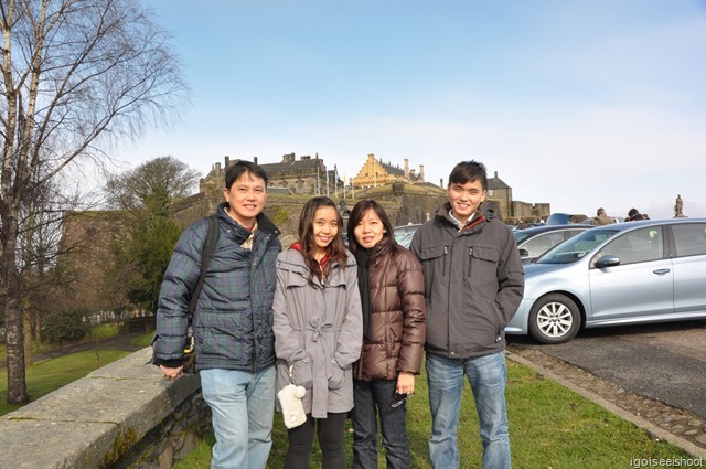
, on top of Abbey Craig, can be seen from Stirling Castle.


We left Stirling Castle and drove towards the Wallace Monument. 10 minutes later, we were at the car-park located at the foot of Abbey Craig where the Wallace Monument is located. There was a small cafe at the visitor centre/ticket office, so we got something to eat before making the “not-so-difficult” walk up the hill to the monument.

There are several ways to get to the monument from below – by a shuttle bus from the visitor centre, walk through the woods or walk along the tar road taken by the bus.

Wallace Monument viewed from the foot of Abbey Craig.


Nice walk through the woodlands up to the monument. Almost there!


This 220 feet (67m) high Victorian Gothic tower was opened in 1869 to commemorate Scotland's greatest freedom fighter, Sir William Wallace.


Close-up view of figure of Sir William Wallace, also known as Braveheart.


From the lookout point at the base of the Wallace Monument, we can see Stirling Castle and the surrounding countryside.


We did not enter the monument to see Wallace's famous double-handed broadsword. Outside, there were some actors re-enacting some historical scenes in a humorous way to entertain visitors.


Actors in medieval costumes, re-enacting some historical scenes to entertain visitors.


As we need to cover quite a long distance today, we did not linger too long here and slowly made our way down via the narrow, winding tar road, making sure we don’t get run over by the shuttle bus that may be coming up anytime.

Making our way down to Visitor Centre.


Wild daffodils – signs of spring.


Coming down via the road was a bit easier and we saw some yellow wild daffodils by the side of the road. Nice way to enjoy the spring weather in Scotland.

Continue Reading »

England-Scotland Day 5 (Part 2) – Loch Lubnaig, Loch Earn

7 April 2010

From Stirling to Killin, we took the A84 northwards through the town of Callandar where we stopped for lunch. After Callandar, the A84 route passes through the Trossachs National Park and becomes very scenic. We stopped by a rest point next to Loch Lubnaig. 

Loch Lubnaig is located about 3 miles from Callander on the left side of the road.


We have heard of the famous Loch Ness monster. Is this the head of a Loch Lubniag Monster near the shore?


Dog at Loch Lubnaig – nice place for a picnic or camping trip

We saw this dog that looked like a stray but it belonged to a family camping nearby.


Loch Lubnaig – nice place for a picnic or camping trip.


A84 next join up with A85 and Loch Earn is located at this junction. We made a short stop by Loch Earn to view the scenery before continuing along A85 north. 

Seaplane at Loch Earn.


Post box at Loch Earn.


This part of the journey on the A85 after Loch Earn was where we hoped to get a glimpse of Harry Potter's train.  We only saw the viaduct for the train from the road at Glen Ogle. We could not stop the car along this motorway. Hence no good picture of the viaduct against the backdrop of the Scottish Highlands.

At some point along the A85, we spotted the sign for A827 towards Killin. The A827 (aka Dochart Road) led us straight into Killin.

Continue Reading »

England-Scotland Day 5 (Part 3) – Killin and the Falls of Dochart

7 April 2010

This part of the A827 is also known as Dochart Road and it led us to Killin and the Falls of Dochart. We cannot missed it as the road passes next to the river. We parked our car by the river bank and walked forward to view the Falls of Dochart.

This is a very fast flowing river and the scenery was awesome!

The above photo shows the Falls of Dochart at Killin and the scenic views of the Scottish Highlands.


Falls of Dochart at Killin, Scotland, Scottish HighlandsLong exposure shot of the Falls of Dochart.


Crossing the stone bridge.


Viewing the Falls of Dochart from the bridge.


This narrow bridge is part of the A827. Only one car passable at any point in time. We walked across the stone bridge and took more photos of the scenery and old water wheel.


Water wheel making use of the fast flowing river to do some useful work. Looking at this wheel, it reminded me of a scene from the movie “The Eagle has Landed”.


Back to our car to continue our journey towards Kenmore, our next stop.


The scenic A827 continued to Kenmore and we had to drive across the raging river using the narrow stone bridge we saw earlier.

Continue Reading »

England-Scotland Day 5 (Part 4 ) – Kenmore and Aberfeldy

7 April 2010

Leaving the Falls of Dochart and Killin, we continued along the A827.  The scenic A827 goes along the shores of Loch Tay and passes through the small village of Kenmore. Many traditional buildings, painted in white and black, lined the main street.  One of the key attraction in Kenmore is the Kenmore Hotel, Scotland's oldest inn.

Entrance to Taymouth Castle. The Taymouth Estate is huge, with golf course and the Taymouth Castle inside. There were nothing much to see except empty grass field (golf course?) beyond this gate. We parked our car here and walked around the small village.

The above picture shows the post office at Kenmore, located opposite the Kenmore Hotel.

Kenmore Hotel, Scotland's oldest inn.


The front entrance of the Kenmore Hotel is striking. Note the black solid tree trunks used to form the pillars.


We stopped at the Kenmore Hotel for lunch. It was past the typical lunch hour so we were the only guests.

After lunch, we went to the back of the hotel which is by the river and watched children kayaking near the Kenmore Bridge and ducks foraging for food by the river banks.

The Kenmore Bridge is built across the River Tay, where the water flows out of Loch Tay we passed by on the way here. The 7-arch stone bridge was built in 1774 and still carries traffic.


Kenmore bridge over River Tay, Scotland.


We drove across the Kenmore Bridge (part of the A827) and continued to next village of Aberfeldy.

Aberfeldy is located about 6 miles east of Kenmore along the same A827. We went to see the Aberfeldy’s Tay Bridge, also known as “General Wade’s Bridge”.

Tay Bridge or General Wade bridge over River Tay at Aberfeldy, Scotland.


This stone bridge is a work of art with the 5 arches and decorated with 4 obelisks on the centre span.


The bridge still carries traffic today but only single lane. So, only one vehicle in one direction at a time. This bridge was part of the network of military roads built under General Wade in 1733.

Black Watch monument at Aberfeldy, Scotland. Located in a park next to River Tay and the bridge. It takes the form of a massive cairn topped with a statue of Private Farquhar Shaw dressed in the original uniform of the Black Watch Regiment.


By the banks of River Tay at Aberfeldy. Beautiful view of Ben Lawers mountains. Scotland.


It was slightly past 5 PM when we left Aberfeldy. Our final place to visit today is the Queen’s View before heading back to Pitlochry where we stayed for the night.

Continue Reading »

England-Scotland Day 5 (Part 5) – Queen’s View and Pitlochry

7 April 2010

Leaving Aberfeldy, we continued along A827 till it joins up with the A9 leading to Pitlochry. We went to see the Queen’s View first before checking into the B&B at Pitlochry. Queen’s View is located about 6.5 miles(10.5 km) west of Pitlochry. This look-out point is called Queen's View, named after Queen Isabella, wife of Robert the Bruce who rules Scotland between 1306 and 1329. But it was made famous by Queen Victoria who came to see this view in 1866.

Access to Queen’s View is via B8019 with access west from the A9. This road is narrow, winding and leads up-hill towards our destination though thick woods. Because of the thick woods, the road was darker than it was supposed to be at 5.30 PM. There were few cars travelling on B8019 at this time of day, in fact, I think we were the only car heading up this road. Nevertheless, we pressed on and soon enough, we found ourselves in the deserted car park next to the Queen’s View Visitor Centre.  To get to the viewing point from the car park, a short hike was required.

View of Loch Tummel. This look-out point is called Queen's View named after Queen Isabella, wife of Robert the Bruce who rules Scotland between 1306 and 1329. But made famous by Queen Victoria who came to see this view in 1866. Scotland, Scottish HighlandsView of Loch Tummel. This look-out point is called Queen's View.


Queen-Size caterpillar at Queen’s View.


This would be a good place for me to photograph the sunset but it would mean driving down B8019 in the dark which was not something I fancied doing. It was slightly passed 6 PM when we left the car-park. We took advantage of the remaining light to get down safely to the A9. Pitlochry is located along the A924, off the A9.

Our B&B is The Well House, near the town centre within Pitlochry.  The host Mary Leaman were happy and relieved to see us as it was rather late when we arrived. The B&B provides free off-road parking at the rear so we left the car there and walked to the town centre for dinner after check-in. There was a Champions League game between Manchester United and Bayern Munich scheduled on TV that night. So, we chose a restaurant that has a TV showing the live game. We were not disappointed. We found a pub showing the game. It was a good game and a good ending to a very enjoyable day.

Continue Reading »

England-Scotland Day 6 (Part 1) – Pitlochry Dam and Power Station and the Salmon Ladder

8 April 2010

Pitlochry Fish Ladder and Dam was constructed between 1947 and 1951, damming up the River Tummel to form Loch Faskally some 5km in length. With such a massive obstacle (the dam) across the River Tummel it was necessary to create a way for the 5,000+ salmon each year to pass upstream to spawn. Hence a Fish Ladder was built next to the dam and it would be a good opportunity to see some salmon swimming upstream.

I planned to visit the Pitlochry Fish Ladder and Dam in the morning before leaving Pitlochry where we had stayed for one night during our road trip.

I was the first to wake up and witness the morning mist drifting into the town from the bedroom windows of the Well House B&B in Pitlochry.

View from the bedroom of the Well House at Pitlochry , Scotland.


After a good breakfast, packed and ready to go, I paid our host, Mr Gordon Leaman, for the stay. I asked him for some directions on how to get to the Pitlochry Dam and Power Station from the B&B by car. The dam is located on the other side of the A9 via Armoury Road and it was easy to find.

As advised by Mr Leaman, we parked the car at the open spaces near the dam and walked along the access road by the river towards the dam. It was drizzling intermittently in the morning sun, so a rainbow was seen over the dam.

Faint rainbow over the Pitlochry Dam and Power Station.


Walking to the dam. The first part of the the Salmon Ladder could be seen on the left.


Pitlochry Dam and Power Station and with the Salmon Ladder in the foreground. The ladder is leading the fish up (away from the dam at this first stage), and then make a U-turn underneath the road and continue up over the dam at the second stage of the ladder.


Second part of the Salmon Ladder, leading up to the dam.


The fish ladder was specially constructed to enable salmon to by-pass the dam and make their way upstream to Loch Faskally above the dam.


The fish ladder was built at the dam to allow salmon to move up and over the 86.5m high dam and get to the spawning grounds upstream. The ladder is 310 metres long and consists of 34 chambers, linked together by pipes that the salmon can swim through.

There are sophisticated counters to keep track of the number of salmon that went up through the ladders each year. About 5000 fish (salmon and sea-trout) used the ladder each year between April and late September.  Glass windows in a viewing chamber allowed close-up view of the fish using the ladder. Unfortunately, we did not get to see any adult salmon while we were there, but we saw a few small fish in the chambers. Maybe we are too early and the migration by the adult fish up the river to spawn had not started.

The Scottish Hydro Electric Visitor Centre was worth a visit to see how electricity is generated from the dam.


A life size model of an adult Salmon is displayed in the visitor centre. It also featured many interactive and educational exhibits.


The Scottish Hydro Electric Visitor Centre also showed the history of the dam building, environment protection, how hydro-electricity is generated, why and how the fish make their epic journey from their birthplace in Highland rivers, out to sea and back upstream to spawn.

As we were leaving the Visitor Centre, we met Mr Leaman again. He had cycled to the dam, in the drizzle, with an umbrella in hand, to look for us and return me some money. I had apparently over paid him earlier due to my mistake in not recognising the denomination of the Sterling Pound notes. A truly honest and commendable gentleman!

Continue Reading »

England-Scotland Day 6 (Part 2) – Pass of Killiecrankie and Soldier’s Leap

8 April 2010

After leaving Pitlochry Dam and Power Station, we backtracked back to Pitlochry town and continued northwards along the A924 and then B8019 to the Pass of Killiecrankie and made a stop to view a place called the Soldier’s Leap. This mountain pass is a natural corridor that links the Scottish Highlands and Lowlands. This is the site of Battle of Killiecrankie in 1689.

Pass of Killiecrankie, Scottish Highlands, ScotlandPath leading to the Soldier’s Leap Viewpoint.


Small waterfall seen along the walk.


River Garry flows at the bottom of the Killiecrankie Pass, with the roadway above.


River Garry with what looks like a railway viaduct.


Walking through the woods towards Soldier’s Leap.


Soldier’s Leap – story behind the place.


Pass of Killiecrankie, Scottish Highlands, scotlandRiver Garry where a soldier is said to have leap across from the rocks here, in order to escape from pursuing enemy that would otherwise take his life. Not an easy feat but when it is a life or death situation, he may have found additional strength and courage.


Looking at Soldier’s Leap and wondering how he did it, i.e. jumped 5.5 meters across this river.


Overall, the Pass of Killiecrankie is a good place to stop and take a walk through the woods and see some historical sights during a road trip. It is also a good place for some bird watching in the woods.

Continue Reading »

England-Scotland Day 6 (Part 3) – On the road to Inverness

8 April 2010

Continuing on the A8079 from the Pass of Killiecrankie, we made a short detour to view the Blair Castle from the outside. and continued back up on the A9 towards our next destination, Inverness.

Inverness is the town on the northern tip of Loch Ness, famous for its monster. It was time to give my son a chance at the wheels for the journey to Inverness and give me a chance to take some photos of the journey. It was a nice scenic drive through the Scottish Highlands.

Driving on the A9 towards Inverness, scotland

Driving on the A9 towards Inverness. This stretch of highway is generally safe and easy to drive but  have to watch out for approaching cars that are overtaking.


Yawning while driving! One hand on wheel!


So few cars on this stretch of the A9 towards Inverness.


Beautiful scenic route on the A9. Snow-cap mountains.


Driving on the A9 towards Inverness, scotland


I took over the wheels again just at the outskirt of Inverness and navigate through the town to find a place for lunch.

Inverness is quite a busy town and my challenge was to find a parking space.  We spotted a Chinese Buffet restaurant called the Jimmy Chung’s Restaurant by the River Ness and decided to have our lunch there before we went looking for Nessie, the Loch Ness monster.

Continue Reading »

England-Scotland Day 6 (Part 4 ) – Loch Ness and the A835 to Ullapool

8 April 2010

From Inverness, we took the A82 along the northern shore of the Loch Ness. Loch Ness is no ordinary body of water. It is the largest of three lochs located in the Great Glen of Scotland and it divides Scotland along a line running from Inverness to Fort William on the southern shore. It is about 37 km in length, but only a width of about 1.6 km at the width point. Loch Ness also has the greatest depth of about 240m and is a seismic fault line. And of course, the legend of the monster that lurks within.

To go around the entire Loch Ness would take too long, so we visited the Loch Ness Visitor Centre located at Drumnadrochit. Some visitors may actually take a boat cruise on the Loch and hope to spot the Loch Ness monster or just enjoy the scenery.  The drive along A82 offered views of the loch and we were hoping that we would be very, very lucky and able to spot the monster along the way.

The Loch Ness Visitor Centre is not just about the monster but also about the Loch and some history. After visiting the centre, I am more convinced that there is no monster living in Loch Ness anymore. There may be a monster in the past but I think the monster would have perished and extinct now. Sad.

Loch Ness, Scottish Highlands, ScotlandLoch Ness Visitor Centre at Drumnadrochit.


Loch Ness, Scottish Highlands, ScotlandWe finally saw Nessie! Lurking at a pond, next to the Visitor Centre car park.


A short drive further down along the A82 from Drumnadrochit is the Urquhart Castle where the Loch Ness monster was photographed in 1955 by a chap called Peter MacNab. A photo of a large object moving through the water of the loch near Urquhart Castle was produced. 

The  famous Urquhart Castle where the Loch Ness monster was photographed in 1955. The so called “MacNab Photograph” of Nessie swimming beneath the castle was controversial and likely to be fake.


Note the wake of a passing boat in the Loch Ness. The boat could be long gone but the wake was still visible in the narrow loch. It could be easily mistaken for a wave caused by the monster.


To visit and walk within the Urquhart Castle site requires payment of an entrance fee. We decided to skip this and head for Ullapool where we will be staying for the night.

To get to Ullapool from Drumnadrochit, there were a few options in terms of route. We chose to backtrack to Inverness on the A82, then take the A9 which took us to the A835 which then leads directly to Ullapool. This was a slightly longer way, but avoided having to navigate through several criss-crossing A-roads in the highlands. In any case, the A835 to Ullapool was a very nice scenic route.

The views along the A835 were stunning and tempting us to stop but it was not too safe to stop on the single lane, winding highway unless there were specially constructed lookout points or rest areas. We finally stopped at a large picnic area by Loch Glascarnoch to enjoy the views and to take some family photos using my camera on the tripod.

Loch Glascarnoch on A835 on our way to Ullapool. The loch is formed as result of the dam built across the river. Scottish Highlands, ScotlandLoch Glascarnoch on A835 on our way to Ullapool.


The loch is formed as result of the dam built across the river. The dam could be seen in the far end of this photo.

Family photo at Loch Glascarnoch – South view of the loch.


Family photo at Loch Glascarnoch – North view of the loch.


The A835, seen on left, goes along the entire length of Loch Glascarnoch. Nice scenic drive.


It was about 6.30 PM when we left Loch Grascarnoch and continued on to Ullapool which was a short drive away. Ullapool is a small picturesque fishing village located on the north shore of Loch Broom. The A835 skirts the north edge of Loch Broom to Ullapool.

Shirley, our host, was waiting for us at the Broombank B&B. As the name implied, the B&B is located on a high ground overlooking Loch Broom. She had some family members visiting her and one of the visiting kid was playing the bagpipes while we were checking in.

Nice welcome.

And she owned a Cavalier King Charles Spaniel! Seeing her dog made me missed our two King Charles spaniels left at home.

After check-in, we took a drive to explore the small village of Ullapool and in particular to look for a place to have dinner. There was a live telecast of Europa League game between Liverpool and Benfica scheduled at 8 PM on TV. So we ate at a pub showing the live game before heading back at half time to watch the rest of the game on TV in our room.

Continue Reading »

Welcome to igoiseeishoot!

Thanks for visiting the igoiseeishoot blog. If you are visiting for the first time, you may want to start here.

This blog is where I share the places I have been to (I go), my experiences at these places, people I met, food I tried and things that fascinated me (I see) and memories of my travels and vacations with lots of photos (I shoot).

I hope you will enjoy reading the posts or find something useful in this blog.

I would love to hear your thoughts or feedback by email (igoiseeishoot@gmail.com) or dropping some lines into the comment boxes of the posts.

Stay connected with me on instagram.