15 March 2025

From Hokitika, we continued our road trip down the west coast to New Zealand’s glacier country. The Fox and Franz Josef glaciers, some of New Zealand's largest and most-visited, descend down from the Southern Alps and flow almost to sea level.
Well, almost.
With global warming, both glaciers had retreated much higher compared to the yester-years and I did not have high expectations on seeing much of the glaciers.
My plan for the day was simple. Drive to the town of Franz Josef Glacier to do a short hike to Peter’s Pool before continuing to Fox Glacier where we would stay for one night. We should have time to do a hike at Lake Matheson before dinner.
The drive to Franz Josef Glacier from Hokitika took about 2 hours. En-route, we made a brief stop at Lake Lanthe Wharf (Google Maps location here) for a coffee break. This is a good place to stop for a short break from driving as there are views of the lake, picnic benches and toilet facilities.

We arrived at the Franz Josef Glacier Car Park (Google Maps location here) as planned. This is the car park nearest to Peter’s Pool.
From the car park, we spotted the Franz Josef Glacier. I had not expected to see any glacier due to the weather conditions but we did! Even then, it was just a tiny bit of the glacier.


We decided to do the impromptu hike to the end of the Forest Walk to get a better view of the Franz Josef Glacier. The signage indicated the hike would take about 30 minutes return or 15 minutes one way.
 Signage pointing to the Glacier View at the end of the Forest Walk.
 It was an easy walk to view the glacier. Along the way, we had a sneak preview of the glacier. Despite the clouds hanging low over the mountain range, there was a break in the clouds, just enough for us to see the glacier with a bit of blue sky above.


At the end of the trail, we arrived at an observation deck with views of the glacier valley and the glacier in the far distance. There is even a small waterfall on the cliff to our right.


I remembered that back in 2004, my wife and I with our 3 kids, did a hike on the glacier valley. We were able to walk right up to the terminal face of the glacier (photo below). We could even touch the glacier and took photos right next to it. Now the track had been closed off for safety reasons.

Photo of our family’s hike to the glacier in 2004. The glacier was longer and reached right up to glacier valley.

It is sad to see that the glacier has receded so far up the mountain due to global warming. Franz Josef Glacier used to fill the whole valley in 1908. According to the sign, glaciers can shift up to 5 meters a day as it melts and retreats.

Nowadays, the only way to really see and touch the glacier is by helicopter to reach the top section of the glacier. This was what we did in 2004 as well.

It was a once in a lifetime experience. So, once is enough.
Peter’s Pool
After seeing the glacier, we took a walk to Peter's Pool as per our original plan. The track to Peter’s Pool starts from the same car park and should take only 25 minutes.


After our little hikes at Franz Josef Glacier, we drove to Fox Glacier, another town named after the glacier next to it. The journey took about 40 minutes, up and down switchbacks across the mountain.
We checked into the Rainforest Motel, our accommodation for the night. I thought the motel looked familiar. It was later than I discovered that we stayed at this same motel back in 2004.
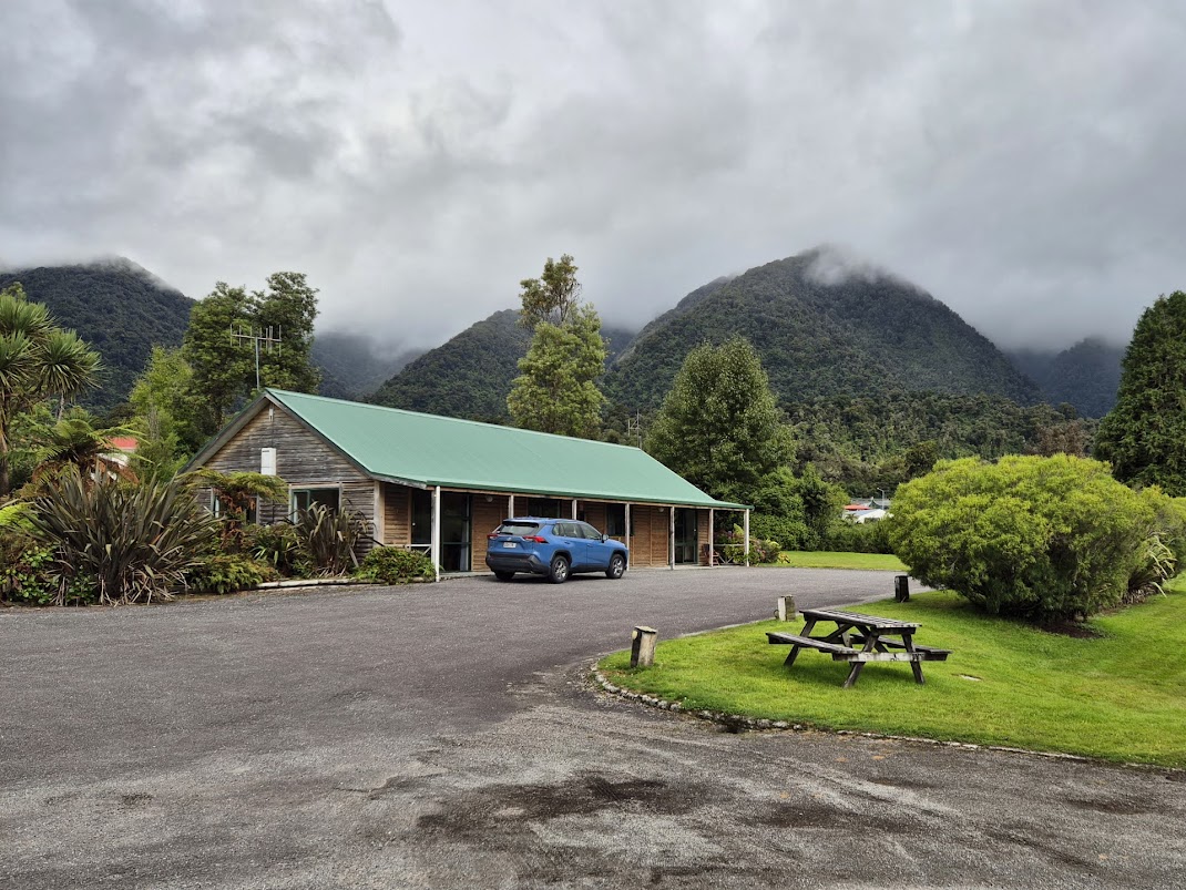
Fox Glacier is a smaller town compared to Franz Josef. I choose to stay here instead of the Franz Josef because of Lake Matheson, located within a few minutes drive from the motel. We had time to freshen up before taking the short drive to Lake Matheson.
Next post: Lake Matheson and what we did at the town of Fox Glacier.

 Rain forecasted for Monday, the day we planned to do the hike up Roy’s Peak for sunrise.
 Departing Rainforest Motel at 7.50 AM.
 Bridge over Fox River. One of the many one-lane bridges along Highway 6.
  Another one lane bridge over Cook River.
 Karangarua Bridge.
 Followed behind this group of cyclists slowly across one of the narrow bridges.
 Driving through a tunnel of trees.
  View of Mahitahi River and the Southern Alps.
 Beautiful landscape as viewed from the car.
 A bit of the rainbow as seen from the car due to the light rain.
 Haast Visitor Center.
 On the Haast Pass Highway (also Highway 6) towards Thunder Creek Falls.
 Thunder Creek Falls.
 Gate of Haast.
 Haast Bridge. This bridge is an impressive crisscross of steel girders – beautifully designed and very sturdy.
 Lake Wanaka with deep blue water and mountains in the back
 Highway 6 along Lake Wanaka.
  Snapping photos at the Lake Hawea Lookout point, just after the Neck.
 This lookout point provides good view of the curvy road going down the side of Lake Hawea.
 Driving down the highway with Lake Hawea on our left.
  Car overtaking a slow vehicle on this dangerous stretch of road.
 Lake Hawea is so blue!
 Views from the Lake Hawea Lookout.
 Hot and spicy Szechuan soup.
 Foo Yong Omelette with whitebait.
 Stir fried beef with ginger and onions.
 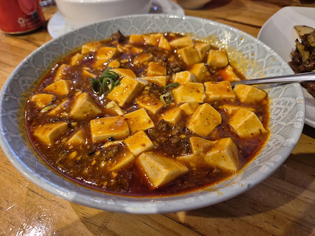 Mapo Tofu dish.