15 March 2025
Lake Matheson is one of the most popular lakes in New Zealand and famous for its mirror-like reflections of New Zealand's highest mountain Aoraki/Mount Cook and Mount Tasman from its surface. I was looking forward to taking some epic photos but the weather on this day did not look favourable.
It was about 6 PM when we arrived at the Lake Matheson car park. There was only one car there and the popular Lake Matheson Cafe had also closed. The sun sets at 7.50 PM, so there was time for us to do the hike while there is still light. In fact, I chose to come just before sunset because the best time for photos is at sunrise and also at sunset when there is usually less wind and also good lightings.
To walk around the lake will take about 1.5 hours but we did not plan to do the whole walk. Most of the epics photos I had seen were taken from an observation deck called Reflection Island. The deck is built out a little way onto the lake providing the most unobstructed views of the mountains. We will only walk to the Reflection Island to see if we could get some good photos.

Like many hikes in New Zealand, we had to cross rivers via suspension bridges.


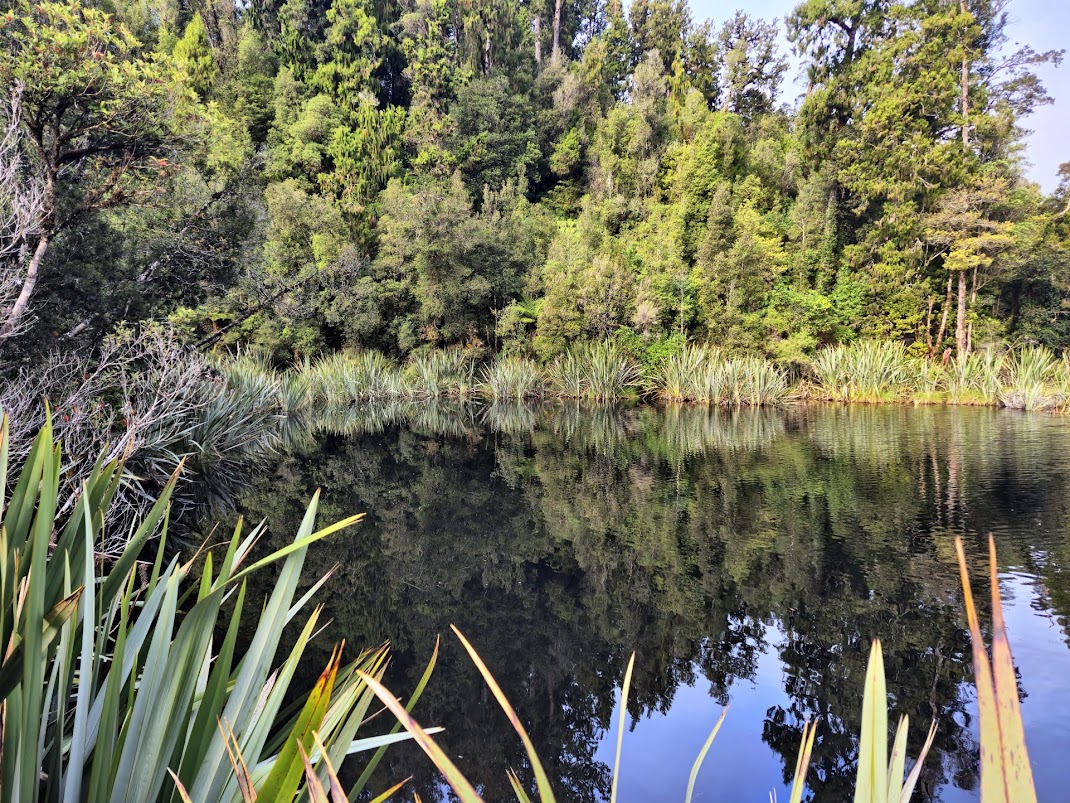
I noticed that the river water below me had an unusually dark colour. In fact, this is why Lake Matheson is so special. The natural tannins in the lake create a very dark brown tone to the water which increases the reflectivity of water surface.
We soon entered a forest with many ferns and moss.


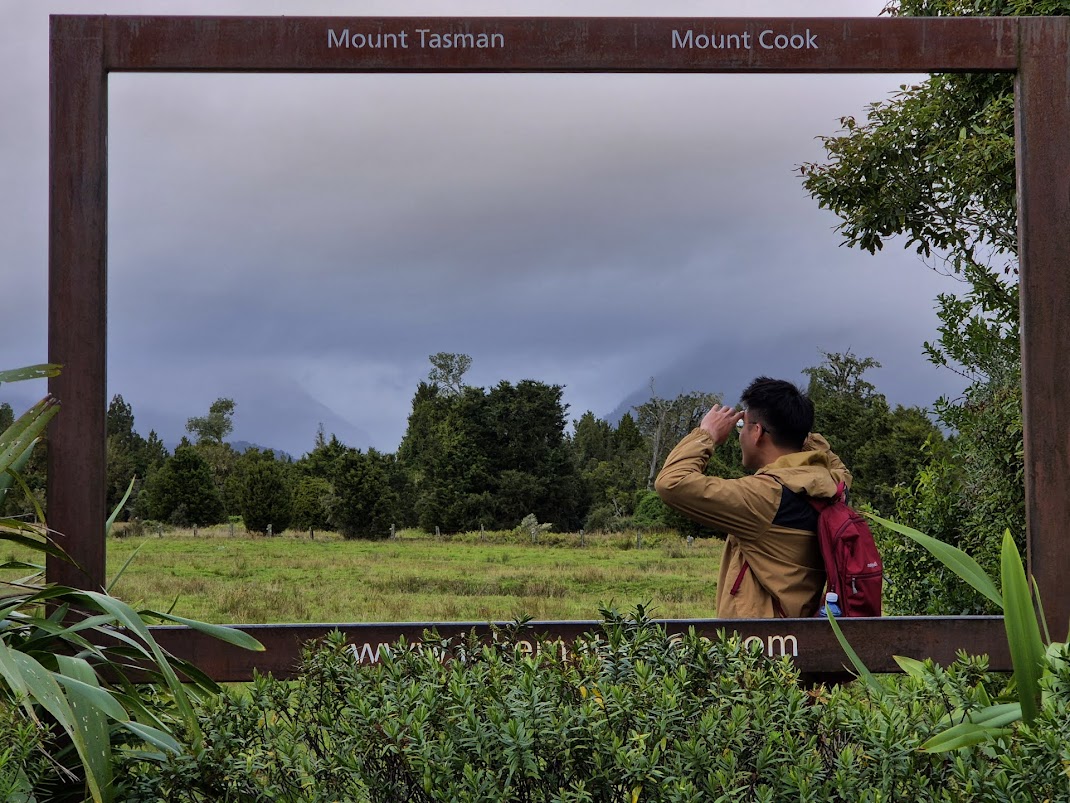
We then entered a clearing where we could “see” Mount Tasman and Mount Cook covered in clouds. The lighting in the hour before sunset, known as the golden hour, is great for photography. It really lit up the grassland and the lone tree, in contrast with the drab grey in the background.

After enjoying the views from the clearing, we entered into the forest again. There was some up and downs as we hiked toward Reflection Island.

We arrived at Reflection Island and saw the disappointing view. The water of the lake was not calm with plenty of ripples. The mountains are shrouded in clouds as expected.

I did not get the epic shot that I was hoping for but there are still some nice views from the lookout point. Ducks and geese were swimming near the shore across the lake and the place was quite peaceful.

The sun was setting behind us and we had an hour before the forest gets dark.
While hiking back to the car park, we discussed about the weather forecast for Wanaka in the next few days. We had planned to do a hike up Roy's Peak for sunrise when we are at Wanaka. This requires us to start our hike at 4 AM, giving us 3 to 4 hours to get to the Roy’s Peak Lookout for sunrise. Rain was forecasted for the day of our planned hike and also the day after. The only time of good weather was on the day that we arrived at Wanaka.
We decided to change our plan. We would now leave early from Fox Glacier, drive to Wanaka through the Haast Pass which takes about 3.5 hours and aimed to arrive by noon for lunch. We will than hike to Roy's Peak for sunset instead of sunrise.
We were the only car in the car park when we returned. On our drive back, we stopped for a moment to shoot some photos of a curious cow with cute marking on its face.


There are not many places for dinner at Fox Glacier. The owner at Rainforest Motel had recommended the Betsey Jane Eatery & Bar, located next to the motel.
The highly rated restaurant was fully occupied when we arrived at 7.30 PM. The staff took our names and told us to come back later at 8.30 PM. There was time for us to take a shower at our motel before dinner.
We walked to the restaurant at 8.30 PM and as promised, we were seated. The food and service at this eatery was quite good. Certainly a good place for a meal when staying at Fox Glacier.


Although we had seen glowworms at Hokitika’s Glowworm Dell, we went glowworm hunting again at Fox Glacier!
The place to see glowworm is at Minnehaha Walk. This is a 20 minutes loop trail through the rainforest, full of old trees, mossy areas, ferns. The entrance to the trail is at the edge of Fox Glacier town, just past Bella Vista Motel. It is marked as Glacier Valley Cycleway Walkway.

There is no parking next to the trail. We parked on the side of the road, in front of Bella Vista Motel, and walked 20 metres to the entrance.
The trail through the rainforest was pitch dark but we brought hiking headlamps, plus light from our smartphones. The trail crosses a few streams and it would not be nice to fall into them in the dark.
After a few minutes walk into the forest, we switched off all lights and let our eyes adjust to the darkness. We saw plenty of pinpoints of blue lights from the glowworms. Once again, we tried photographing the glowworms but it was not easy.

We actually walked the entire loop of the Minnehaha Trail which took about 20 minutes. We stopped a few times to view the glowworms. It was a little eerie to be in the middle of the pitch dark forest but my son and I are used to this, having served in the armed forces. My wife felt a little uncomfortable but I guess the sight of the little insects made up for it.

 Rain forecasted for Monday, the day we planned to do the hike up Roy’s Peak for sunrise.
 Departing Rainforest Motel at 7.50 AM.
 Bridge over Fox River. One of the many one-lane bridges along Highway 6.
  Another one lane bridge over Cook River.
 Karangarua Bridge.
 Followed behind this group of cyclists slowly across one of the narrow bridges.
 Driving through a tunnel of trees.
  View of Mahitahi River and the Southern Alps.
 Beautiful landscape as viewed from the car.
 A bit of the rainbow as seen from the car due to the light rain.
 Haast Visitor Center.
 On the Haast Pass Highway (also Highway 6) towards Thunder Creek Falls.
 Thunder Creek Falls.
 Gate of Haast.
 Haast Bridge. This bridge is an impressive crisscross of steel girders – beautifully designed and very sturdy.
 Lake Wanaka with deep blue water and mountains in the back
 Highway 6 along Lake Wanaka.
  Snapping photos at the Lake Hawea Lookout point, just after the Neck.
 This lookout point provides good view of the curvy road going down the side of Lake Hawea.
 Driving down the highway with Lake Hawea on our left.
  Car overtaking a slow vehicle on this dangerous stretch of road.
 Lake Hawea is so blue!
 Views from the Lake Hawea Lookout.
 Hot and spicy Szechuan soup.
 Foo Yong Omelette with whitebait.
 Stir fried beef with ginger and onions.
 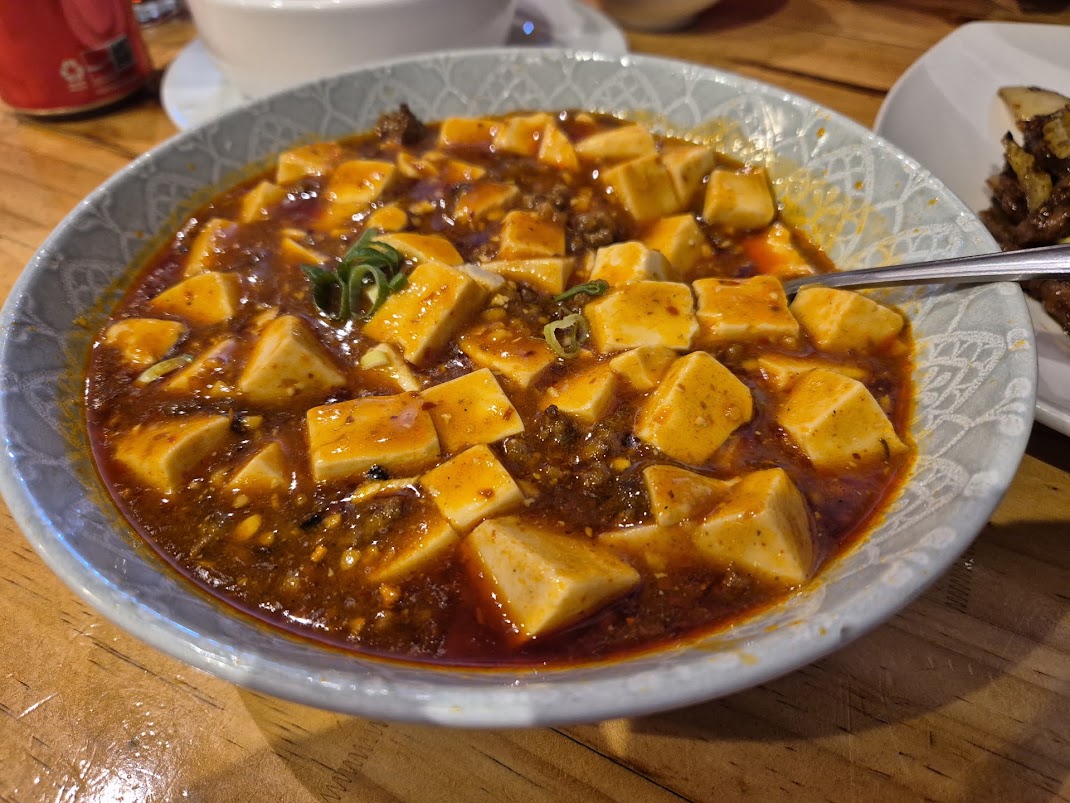 Mapo Tofu dish.