4 November 2024

From one onsen town, we drove to another. Kurokawa Onsen is only 48 km from Yufuin and the driving time without stopping was slightly over an hour. We planned to make some slight detours in order to see Kyusuikei Gorge with Tengu Waterfall, Kokonoe Yume Otsurihashi suspension bridge and the Tadewara Wetlands along the way.
We left Yufuin at about 11 AM via National Highway 210 with Kokonoe’s Tengu Waterfall as our first stop. National Highway 210 was easy to drive. We came via this highway when we drove to Yufuin the day before. From Highway 210, we turned into the smaller and narrower Route 40. The country road followed a river and was quite scenic, with views of the river, paddy fields, farmhouses and also forest.
As it winds its way up the mountain, we had to be more careful as this single carriageway has many sharp bends with blind corners. The width of the road is also not regular and at some parts barely wide enough for two cars to pass each other. I had to make a sudden stop at one point when the road suddenly narrows with an oncoming car heading down the slope towards me. If I did not stop, I would have sideswiped that car.
After the narrow escape and negotiating a few hairpin turns up the mountain, I was glad we arrived at a large car park near our first destination which is Tengu Falls at Kyusuikei Gorge. The car park is located next to a store that sells food and local produce and is within walking distance to the waterfall.
I was surprised by the number of cars in this large car park. Must have been due to the autumn season as Kyusuikei Gorge is one of the places in Kyushu that boasts of nice autumn foliage.

Apparently, there is no free parking at this car park overlooking the gorge. An attendant handed us a ticket which we need to get validated when we buy food or things in the local product store.
Katsura Chaya

Katsura Chaya is a local produce store with a restaurant selling udon, soba noodles, rice bowls and drinks. We did not really like the food in the menu and there was a queue at the store to order the food. We went to check out a food stall in front of the store instead. There was a man grilling dango (Japanese dumplings) and yamame (local river fish) on skewers over a charcoal fire. I had read that the grilled fish here is good.

We then took a seat on a table in the restaurant with views of the gorge below. While my wife started on the fish, I went to use the washroom. When I returned, she was gone.

Apparently, the tables in the restaurant were meant for customers who ordered from the menu in the restaurant. We had been asked to move to a table behind the fish stall.
OK, our bad. We had assumed that the stall is affiliated to the chaya.
The grilled fish looked charred and overcooked. We used the chopsticks to remove the charred skin. Surprisingly, the flesh inside has a delicate texture with a delicious and sweet taste.
Tengu Waterfall
We went to take a look at Tengu Waterfall which was about 20 meters away. There is a little shrine overlooking the river and a pair of giant red slippers.


As we leave the car park, I handled the parking ticket to the attendant thinking that I had already validated the ticket and paid for the parking. He asked for 200 yen more. I was not sure how the parking system works. So I just pay up and get on with it.
Kokonoe Yume Otsurihashi
We arrived at the Kokonoe Yume Otsurihashi car park a short while later. Parking is free but entrance fee to the suspension bridge is 500 Yen per person.
On the side of the large car park there are restaurants and small shops offering local food, ice creams and local produce as well as a tourist information service and toilets. The ticket booth is at the tourist information center, not at the bridge.
We had to show our tickets to the attendants at the entrance to the gate before allowed entry. You are not allowed to cross the bridge with an umbrella due to possible strong wind. We put on our hiking jackets as it was quite chilly with the wind.


The graceful bridge could sway a little as it was suspended by cables all the way at a height of 173 m above the river valley floor.
As I have a little fear of heights, it was thrilling for me to step on the bridge and view the deep ravine below. I was hoping no earthquake happens while we were on the bridge.

The bridge is also a good place to view three waterfalls, collectively known as the Shindo Falls and renowned as one of Japan’s top 100 falls. They comprise the ‘child’ falls, Ko-daki, the ‘female’ falls, Me-daki and the ‘male’ falls, O-daki.


It did not take long to cross the 390 m long bridge. At the other side, there are attendants checking for tickets as well, since there is an entry and exit gate. Visitors could leave from there to take a road up a hill where there is a shrine with a white python and also views of the bridge from a distance.

We did not continue up the hill and crossed the bridge again to get back to our car. From there it was a 10 minutes drive to Tadewara Wetlands.
Tadewara Wetlands
Situated on the northwest side of the Kuju Mountain Range at an elevation of approximately 1,000m above sea level, Tadewara Wetlands offers hikers and nature lovers a chance to take a walk through fields of flowering reeds in autumn, breathe fresh air while looking up to mountains nearby.
We parked at the free car park opposite the Chojabaru Visitors Center, crossed a signalised road junction to get to the entrance.
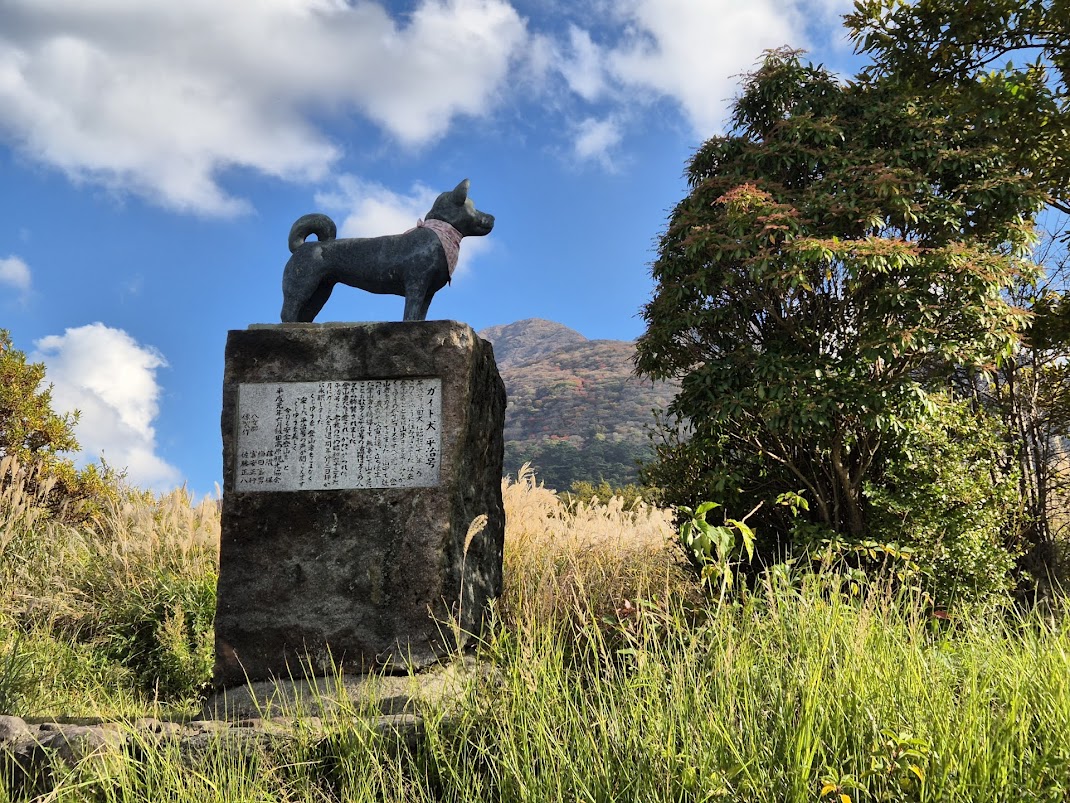
We entered through a path next to the statue of a dog. We could not figure out the significance of the dog statue. It looked very much like the Hachiko statue in Tokyo but probably had a different back story.
In autumn, the wetland area is covered with tall brown reeds, very similar to those we saw at Jeju’s Sangumburi Crater. The silver reeds made the area very pretty.


Each route is on cedar-tree boardwalk specially built to allow close-up views of the flowers and plants growing in the wetlands without fear of trampling over them.
We chose to take the shortest route as we meant to do sightseeing, not long hikes on this day. This place is also the starting point for longer hikes to the nearby Mount Mimata.


There are platforms with seats along the boardwalk for those who want to take a breather or linger amongst the field of reeds. We sat down on one of the seats to have a break and eat our Snickers bar. This place was really peaceful and relaxing. I wished we had more time to enjoy the fresh air, sunshine, scenic views and nature all around.
It was about 3.30 PM when we continued our drive to Kurokawa Onsen via Highway 11, also known as the Yamanami Highway. It is a scenic route that traverses through the Kuju mountain range. Originally, I had planned a short stop at the Makinoto Observatory to take a short hike to an observatory. I aborted this plan as we wanted to get to our ryokan in Kurokawa Onsen by 4 PM.

Kurokawa Onsen is an idyllic hot spring town, with charming traditional ryokans, and renowned as one of the most popular hot spring spots in Japan. The landscape is dominated by wooden buildings with natural colors and materials, earthen walls, stone stairs and a river flowing through.

After staying at the excellent Yufuin Bettei Itsuki ryokan in Yufuin, we would be pampering ourselves again at the Yamabiko Ryokan in Kurokawa Onsen.

More about our stay at the Yamabiko Ryokan in Kurokawa Onsen in the next post.
 Map of Kikuchi Gorge showing the routes and highlights to look out for.
  Hydroelectric power weir and the red bridge we had to cross to start our hike.
 First part of the trail. The rest of the trail going upriver is quite similar.
 Stone Buddha covered in moss.
 Kikuchi Gorge offered many photo opportunities.
  One of the many rapids on the river.
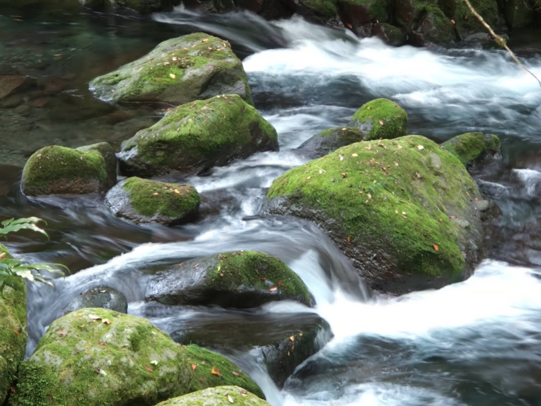 Long exposure shot of the water flowing over the moss covered boulders.
 Pool with some of the clearest and bluest water.
 Information board explaining the name of Reimei Falls. There were many such boards along the trail.
 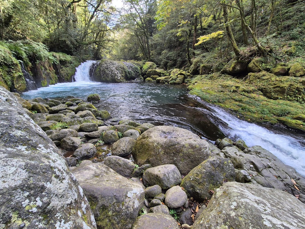 Reimei Falls on the top. It further cascade down into the blue pool below.
  It is possible to walk quite close to the edge of the cliff to feel the roar of the water.
  Momijigase would have been stunning with red and yellow autumn leaves.
 Long exposure shot of the boulders and water flowing.
 View of Tengu Falls and Ryugabuchi pool from the bridge.
 View from the bridge of the river flowing down the valley. So green and tranquil.
 Long exposure photo of the flowing water.
 Yonjusanman Falls
 Hogan Keyaki, a zelkova (keyaki) tree that grows on top of a massive boulder.
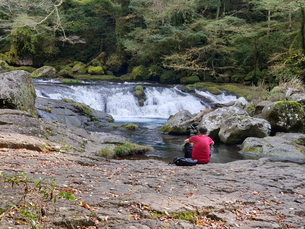 Resting on the rocks by the river.
 View at Hirokawara.
 The second bridge is the furthest we would go on the longer route.
  View from the second bridge.
 On the return path to the entrance of Kikuchi Gorge.