11 November 2022
Our hike for the day is Jeju Olle Trail Route #10 from Hwasun Golden Sand Beach to Songaksan (Mount Songak).
Note: we had hiked Jeju Olle Trail Route #6 the previous day. Route #6 is another highly recommended Jeju Olle Trail.
Although the end point for the Jeju Olle Trail Route #10 is at Hamo Sports Park in Moseulpo, covering a distance of about 15.6 km, our plan is to hike the coastal trail to Songaksan only, covering a distance of only 8.5 km.
Only 3 couples would be doing this hike. Earlier in the morning, our driver cum guide, Mr Won, sent Annabelle (accompanied by Jude) to the Seogwipo Medical Center to seek medical treatment for injury to her foot sustained two days ago.
After alighting us at the start point of Route #10, he drove back to the medical center to assist them.

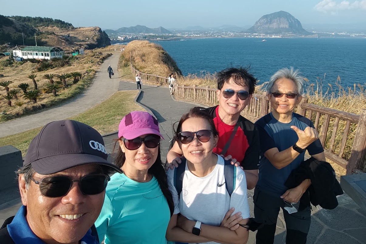
Group photo taken with the help of our driver at the start point of Jeju Olle Trail Route #10.
Hwasun Golden Sand Beach
Hwasun Golden Sand Beach is supposed to be one of best destination for family swim with soft sand and shallow water. However, the beach was practically deserted in autumn. We saw some people camping and relaxing by their campervans.

Campervans at Hwasun Golden Sand Beach.
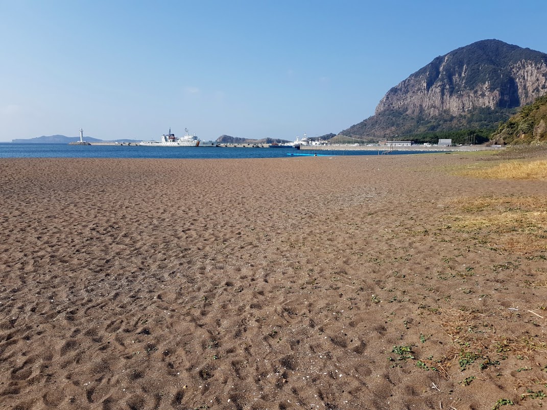
View of Sanbangsan (mountain) seen from Hwasun Golden Beach.
It was about 10.30 AM when we started our hike down the beach, following the Olle markers of blue and orange ribbons, plus signposts. We passed by an empty and deserted outdoor spring water pool before heading inland and up a small hill.
We could see a pier with coast guard vessels and looking back, we could see Hwasun Golden Beach.

Looking back at Hwasun Golden Sand Beach as we headed uphill.
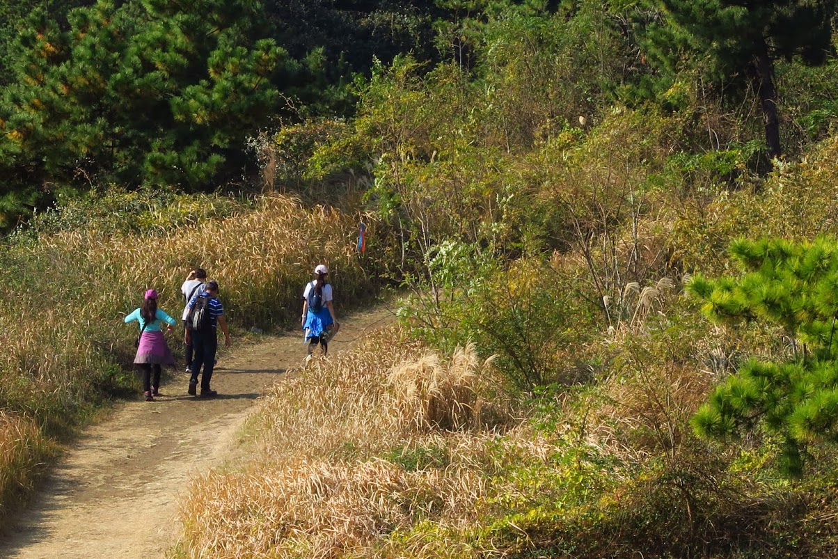
Following the Olle Ribbons

Ribbons tied to trees are one of the many Olle trail markers.
Hiking in Jeju is easy with the Olle trails. There are 26 different walking and hiking courses circling the island. The trails are remarkably well designed and well marked. Hikers just need to follow markers along the journey. The symbols could be blue arrows at junctions, a blue horse, ribbons tied to trees or signposts, or arrows painted on the footpaths or walls.
The blue arrows mark the direction from the starting point to the finish point, typically in a clockwise direction round Jeju Island. Since some people may do it the other way round, you can also follow the orange symbols if you start at a finishing point and hike towards the starting point. Routes were always clear but subtly marked.
More information about the Jeju Olle trails can be found at this site, Jeju Olle Trail Official English Guide.
 Beautiful coastal scenery and beaches are a common sight along the Olle Trail Route #10.
Sanbangsan - a bell-shaped lava lump could be observed almost anywhere along the trail.
We soon got sight of the majestic Sanbangsan as we headed down the hill. It was a nice and warm autumn day with temperature forecasted to be around 20 to 22 degree Celsius. I wished the weather was cooler as I was perspiring a little.
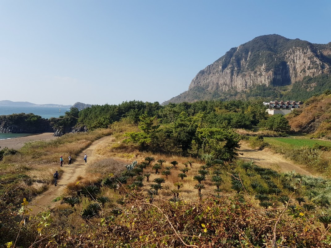

I lingered on the hill to snap some photos of my hiking companions who had made their way down the hill ahead of me.
Zoomed in view of my hiking companions.

One of the many golden sand beaches seen along the trail.

We spotted a guy fishing on the rocks.
One and Only Cafe – Our One and Only Pit Stop
We arrived at a cafe called the One and Only Cafe located at the foot of Sanbangsan about one hour into our hike. This cafe is impossible to miss as the Olle trail passes right by the beach next to it.
This is a very popular cafe since it has the stunning Sanbangsan mountain view at the back and the beautiful ocean view at the front.

One and Only Cafe with Sanbangsan in the background.
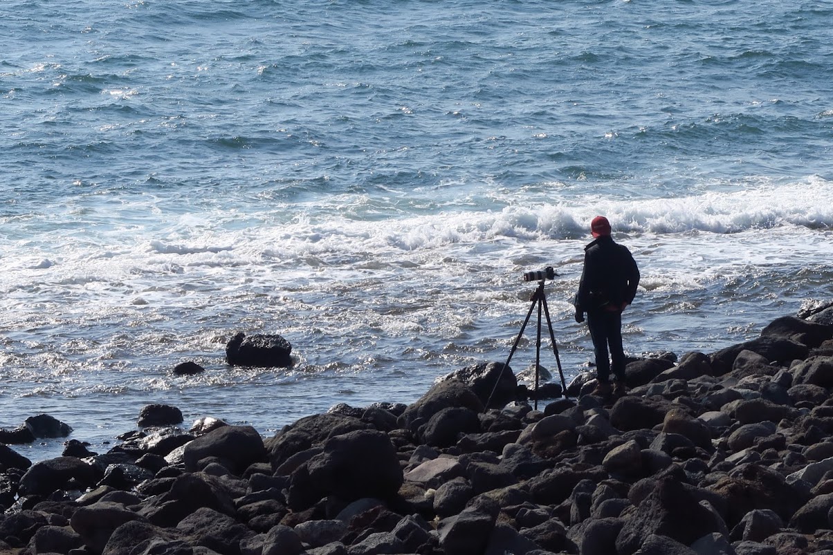
Photographer at rocky part of Hwangwoochi Beach, next to One and Only Cafe.
In addition to its excellent location next to a beach, the ground of the cafe is adorned with many palm trees that create a Hawaiian vibe.

The outdoor deco at this cafe, with sounds of the waves, provided a relaxing and resort kind of feel.

We sat outdoor, next to the sea.
This cafe was very popular and crowded and we were lucky to find a table for our group of 6 at the garden, next to the beach.
Each couple ordered an iced mocha and a banana crumble pastry to share. The coffee is average and the pastry was a little too rich and filling for me.

Nice looking banana crumble pastry. Does this pastry that looked like a waterfall or lava flowing down a mountain?
We spent nearly an hour at this cafe. While we were sipping our coffee and eating our pastry, we were getting updates from our friends at the medical center. An X-ray showed that Annabelle had a minor fracture in her foot.
Mr Won brought them to the cafe to meet us, just as we were about to continue on our hike. She was in crutches and her foot was in a plaster cast.
While Annabelle and Jude get to enjoy their time at the One and Only Cafe, we continued on our hike. We arranged to meet up with them again at Songaksan, the end point of our hike.
Sanbang Yeondae (smoke signal tower)
From the cafe, we followed the Olle route markers along the beach and climbed up another hill.
It was very windy at the summit of this hill. Apparently, there is a smoke signal tower on this hill but I did not see it.

A blue horse is another kind of Olle route marker that provides information about the location.
It was quite scenic on this hill. Looking back, we could see Hwasun Golden Sand Beach, our start point and traced our journey to Hwangwoochi Beach, where the cafe was located.

Looking back, we could see Hwangwoochi Beach.
Hamel Monument
We soon see the Yongmeori Coast, supposedly a rock formation that looks like a dragon jumping into the sea. I think a lot of imagination would be needed to figure out where is the dragon from my point of view.
There is a replica ship built here to commemorate the shipwreck of the Dutch explorer Hendrick Hamel and his time on Jeju Island.

Blue and Orange Olle ribbons fluttering in the strong wind and the replica ship on the Yongmeori Coast below.

Zoomed in view of the replica ship.
At this location, there is a Monument of Hamel built by the Netherlands Embassy in Korea with Korea International Culture Association on April 1st, 1980 in memory of Hamel and as a sign of friendship between the Netherlands and Korea.

Hamel Monument on the hill overlooking Yongmeori Coast.

Hamel was forced to stay in Korea for 13 years. Later he returned to the Netherlands and was the first Westerner to write a book on Korea.
Yongmeori Coast
Yongmeori Coast, translated as Dragon’s Head Cliff, was one of the highlights in my previous visit to Jeju.
During good weather and low tide, we could take a walk round the coast which was an interesting and exciting experience. Check this blog post for my previous experience walking round Yongmeori Coast.
Unfortunately for my hiking companions, it was high tide when we arrived at this place and the trail was closed.
 Start point of the trail around the Yongmeori Coast, half covered by the sea at high tide.
There are cafes, food stalls and even a small amusement park at the Yongmeori Coast.
We also caught sight of a prominent golden statue of Buddha, located at the Sanbanggulsa Temple.
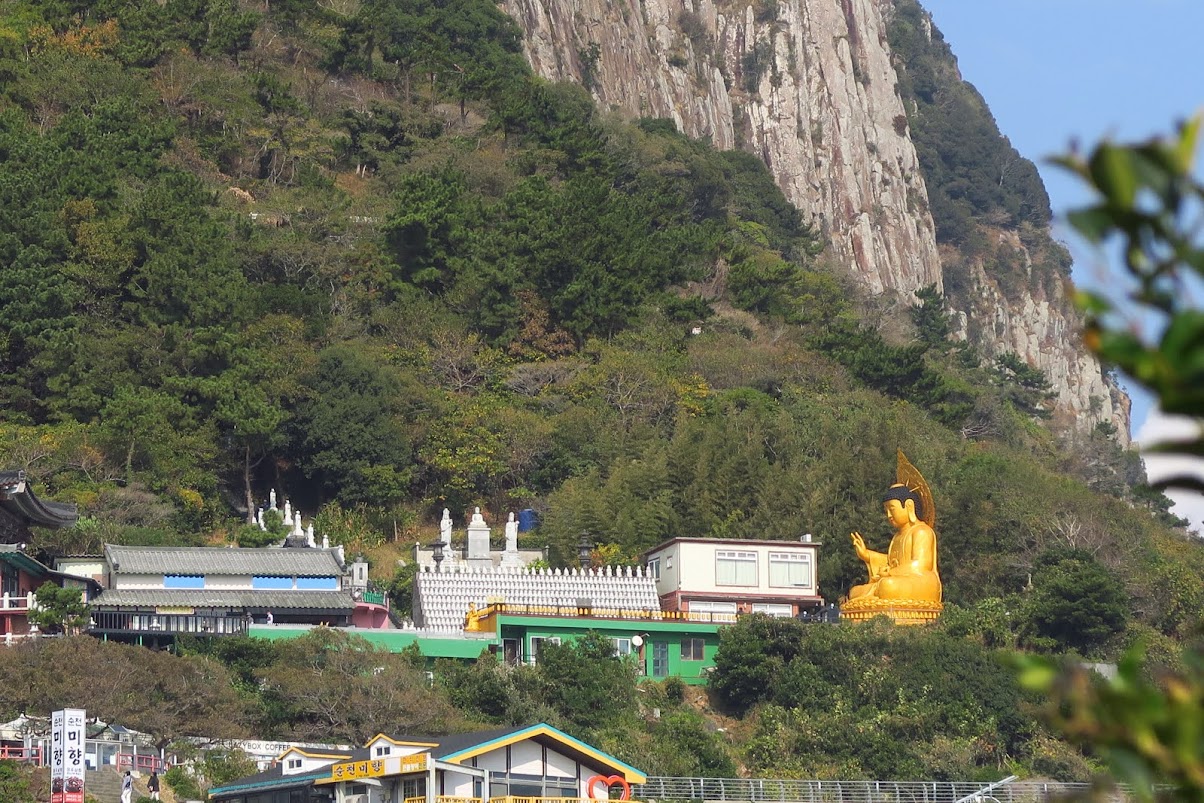
Sanbanggulsa Temple with the Golden Buddha statue at the foot of Sanbangsan.
Sagye Port
Leaving Yongmeori Coast, we followed the Olle trail markers leading into the residential area in Sagye and Sagye Port. There are numerous seafood restaurants and cafes in Sagye.
We could have stopped for lunch at Sagye but we had decided to press on in order to reach Songaksan car park by 4.30 PM to rendezvous with Jude and Annabelle.


Sagye Port.

Fishing Boat at Sagye Port with rows of lights at the bow and stern.

Interesting statues of an elderly haenyeo giving tips to two young haenyeos at Sagye Port.
We got a close up view of the concrete tetrapods, a common sight in the coast around Jeju. Tetrapods use a tetrahedral shape to dissipate the force of incoming waves by allowing water to flow around rather than against them. Their shape also allows easy interlocking and hence reduces displacement.

My friend saying hello to a cat resting amongst the tetrapods.
Sagye Beach
Just past the port, we came to Sagye Beach. The first part of this beach has very interesting rock formations. It was worth a stop to take some photos at this location.

Start of Sagye Beach with the port and breakwaters of the port in the back.

Interesting rock formations caused by erosion at Sayge Beach. The red Sagye lighthouse could be seen in the back.
This place is quite interesting and there were many family groups playing and enjoying their time on the strange looking rocks.


The sea is quite unpredictable here. One moment it was nice and calm and next moment, angry waves came crashing onto the rocks. It is best to stay clear of the edge and be wary of the ocean.


Waves crashing on the rock formation at Sagye Beach. The two islets in the background are the Hyeongjeseom Islands.
All along Sagye Beach, we could see Hyeongjeseom Islands, a pair of islets lying at about 2km from the shore. “Hyeong” means brother in Korean. One island is big and the other is small, so they look like brothers that are facing each other.
Leaving Sagye port and town behind, we continue along Sagye Beach. The ocean off this beach has extraordinary colours, in different shades of blue.

Different shades of blue in the sea off Sagye Beach.

Taking a rest and enjoying the views at Sagye Beach.
The views are gorgeous. Looking back, we could see Sanbangsan, blue sky above us, turquoise sea on one side and golden fields of grass around us.
Viewing Sanbangsan from Sagye Beach, we could make out its distinct bell shape. There is a legend in Jeju that some angry god plucked off the peak of Hallasan and threw it to the west into the ocean. Hallasan is left with a hole that is now Baengnokdam Crater and the plucked mountain in the west sea is Sanbangsan. There may be some truth in this legend as the circumferences of Sanbangsan and Baengnokdam Crater at Hallasan are about the same!

Wind in our hair, golden fields, blue sky, turquoise sea and Sanbangsan behind us.
The rest of our hike along Sagye beach provided alternate views of either sandy or rocky coastline. There is supposed to be a place along this beach where one could see 15,000 year old fossilised footprints but we missed it.

Stopping to look at sea birds on the beach.

Sea birds resting on the beach.


Towards the end of Sagye Beach, we could see Songaksan and a small town ahead. The town is mostly cafes and restaurants along the Sagye Coastal Road.
Songaksan is a low volcanic cone located on a small peninsula that protrudes into the sea. We could see some man-made caves along the coastal cliffs.

Songaksan with caves along the coastal cliffs below.
A signboard explained the origin of the caves at Songaksan. They were built by the Japanese during their 35 year occupation of Japan. They were built as part of their military facilities to use for suicide attacks using small ships against the fleet of the Allied forces during WW 2. There are 17 caves along the coastal cliffs of Songaksan, built using forced labour of Jeju residents.
It is also a terminal for ferry to and from Marado.

Ferry from Marado, arriving at the pier at Songaksan. The two islets in the background are the Hyeongjeseom Islands.

Songaksan
We arrived at Songaksan car park at about 3.15 PM. Co-incidentally, Mr Won drove in with Jude and Annabelle at the same time.
After a short discussion, some of us proceeded up Songaksan while the rest went to have a coffee break at the Mega Coffee, a cafe located next to the Songaksan car park.
The Songaksan hikers, including Jude with fresh legs!

Stone marker at the entrance of the trail to Songaksan or Mt Songak.
Songaksan is a low volcanic mountain that juts out into the sea. There are trails leading to the summit as well as a coastal trail that loops around the mountain.
The coastal trail around Songaksan is probably one of the most beautiful sections of the Olle #10 Trail. Looking inland, we could see horses grazing on the prairie and looking outward, we could see dramatic coastal views.
We got some of the best views of Sanbangsan from Songaksan. The views got better and better as we climbed the gentle trail along the coast.

View of Sanbangsan from Songaksan. The 395-meter high Sanbangsan dominates the otherwise relatively flat landscape in this part of Jeju.

View of the town near Songaksan with a ferry pier, cafes and restaurants.


Another view of Sanbangsan from Songaksan, framed by the rock cliffs on Songaksan.

More caves could be seen along the trail. A signboard explained these were part of the 60 over cave trenches built by the Imperial Japanese Military (IJM) between 1943 and 1945 on Songaksan. They were proof that the IJM were fortifying Jeju as part of their last ditch defense against the allied forces during WW2. Included in these fortifications were the Alddreu Airfield with trenches, bunkers and hangers for fighter planes.


Olle Trail #10 Route continues to the Alddreu Airfield after Songaksan. Personally, I would have liked to take a look at Alddreu Airfield but we did not proceed further than Songaksan.
We turned back after a short rest at the windswept view points where we could see Gapado and Marado islands. Marado is the southern-most point of Korea.
We watched with interest as a red and white ferry rocked and rolled in the surf below us, struggling towards the pier near the car park.

The passengers on this ferry must be feeling sea sick from the choppy sea off Songaksan.
Mega Coffee
We met up with the rest of the gang at Mega Coffee. Mega Coffee is a cafe chain known for being popular with young people due to their bargain prices. Good coffee at bargain prices indeed.

Our driver cum guide, Mr Won, with some of my travelling group at Mega Coffee.
Songaksan and Mega Coffee was the last stop of our hike.
Overall, we had covered the most scenic part of the Olle Trail #10. We completed the 8.5 km trail from Hwasun Golden Sand Beach to Songaksan in about 6 hours, with plenty of stops for photos and breaks.
No comments:
Post a Comment