22 March 2025
After completing the Hooker Valley hike in the morning, we had time for a short afternoon hike at Tasman Valley before leaving Mount Cook National Park for Lake Tekapo. There are a few hiking trails at Tasman Valley and I opted to do the hike to Tasman River.
The walk begins from the Tasman Glacier Car Park (Google Maps location here) at the end of the Tasman Valley Road. The road is off State Highway 80, just outside Aoraki Mount Cook Village. We drove along the scenic Tasman Valley Road for about 7 km to the car park.
At the car park, there are bathrooms and a shelter where we had our picnic lunch. By the time we finished our lunch, it was 1.30 PM. From the shelter, there is a single trailhead that starts as the Tasman Glacier View Track.
About 200 metres later, the track splits at a fork with the left fork leading to Blue Lakes and Tasman Glacier View and the right fork leading to Tasman Lake jetty and Tasman River.

Hiking at this time of day was not so pleasant. Although the views of the Tasman Valley with spectacular lenticular clouds above were awesome, we were reeling from the warm weather.


After about 800 metres along the track, we reached another junction. The left trail leads to Tasman Lake Jetty. This jetty is where the people taking the boat and kayak tours on Tasman Lake enter the water. We met some folks who had completed their tour and walking back to the car park.
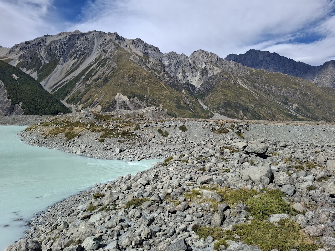
We took the trail on the right fork that leads to the source of the Tasman River, where the water from the lake drains into the river.

After about 20 minutes into the hike, we arrived at the end of the official trail. We could scramble up the edge of a moraine in front of us or scramble down over large boulders to the water’s edge.
We walked up the slope of the moraine to get a better view of the lake. We could see Mount Cook at the far side of the lake.


We could see some people gathered around the Tasman Lake Jetty a short distance away. My son and I were tempted to do a hike on top of the moraine to get to the jetty but decided it was not worth the effort and risk since the moraine is mostly rocks and loose gravel.


There seems to be a trail down to the edge of the Tasman Lake and Tasman River but it would require scrambling over some large boulders. We decided not to risk our lives and limbs.


After a short rest and soaking in the views, we made the short but arduous walk back to the car park under the hot afternoon sun. With more time and energy, we may have tried hiking the other trails to the Blue Lake and Tasman Glacier Viewpoint. The weather was just too warm for more hikes. We decided to say goodbye to Aoraki/Mount Cook National Park and continue on our road trip towards Lake Tekapo.
Overall, I did not enjoy this hike as compared to the more scenic Hooker Valley hike. Maybe it would have been better if we had done the hike in cooler climate, and perhaps hike to the Tasman Glacier Viewpoint and Blue Lake (i.e. take the left fork at the first junction) instead of Tasman Lake Jetty and Tasman River.
No comments:
Post a Comment