7 November 2022

The day before, when my plane was coming to land on Jeju Island, I saw a mountain located in the central part of the island that was half covered in clouds. This mountain is Hallasan, a massive shield volcano that erupted millions of years ago, key in the formation of Jeju island, and is now dormant. I had plan to hike up Hallasan during this trip and was glad to see that the slope of the mountain is not too steep.
The plan for the second day of our trip was to hike up Hallasan, the highest mountain in South Korea offering a once-a-lifetime experience for adventure seekers. This was the day that some of the avid hikers in my travelling group were looking forward to while this was also the day that a few in my group who did little hiking prior to this trip dreaded.
There are 7 hiking trails going up the 1,950 m mountain, but only two trails, the 8.7 km long Seongpanak Trail and 9.7 km long Gwaneumsa Trail, reach the very summit offering a look into the now dormant Baengnokdam crater that has a depth of 108 meters and a width of 550 meters. In view of our aged knees and lack of physical fitness, we skipped these.
We decided to do the 3.7 km Yeongsil and 4.7 km Eorimok Trails instead. These trails are short and relatively easy for beginners, we were told. Both trails meet up at Witse Oreum, mid point up Hallasan. Our plan was to ascend via Yeongsil Trail and descend via Eorimok Trail. These trails offer good views along the way as well as Baengnokdam in the background.
Although one could use the public buses, the best way to get to the start of the Yeongsil hiking trail is by rental car or hired taxi.
Our taxi driver for this trip, Mr Won, picked us promptly at 8 AM from our hotel in Jeju City and drove us to the start of the Yeongsil Trail. The journey took about 45 minutes.

Mr Won turned on the karaoke system in his van and we were entertained by some “oldies but goodies” singing.
Upon reaching the Hallasan park office and entrance of the road leading up to the Yeongsil trail, we discovered that our jumbo taxi was not allowed to proceed further. Probably the upper car park, located at the trailhead at the end of the road, was completed filled and we had to park at the lower car park.
Walking up to the actual trailhead from the lower car park is a 2.1 km walk and would take about one hour! Mr Won managed to flag down a passing regular taxi to ferry our group of 8 to the trailhead in two trips for a fee of 20,000 KWR.The upper car park at the start of the trail head was indeed full and there were many groups of hikers already gathered there.
One of my travelling companions fished out a bunch of bananas from his backpack and we consumed a banana each before starting our hike. Good to load up on energy food and reduced his load.
There were loud messages in Korean language being blared out from the PA system basically informing hikers to bring their own bag for the rubbish.
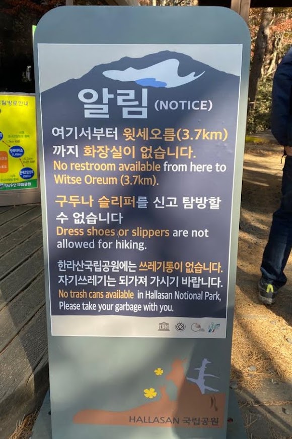
Like most places in Jeju, there are no bins within Hallasan National Park.

Stone marker at the start of the Yeongsil Trail at 1280 m ASL (Above Sea Level).
By the time we started our actual hike, it was almost 10 AM, about an hour behind schedule.
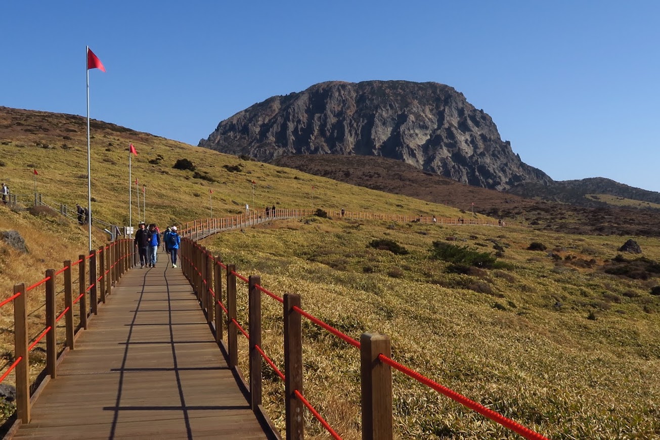
Initial part of the trail was through a forest and gradient was gentle. We were walking on wooden planks and boardwalk most of the time.


Easy part of the trail.
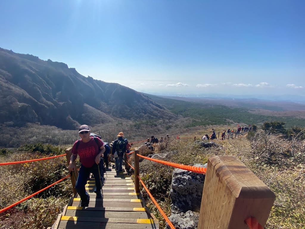
We soon reached a steeper part of the trail. There was a slight “human congestion” as some parts of the steeper trail are only wide enough for 2 persons.

The Yeongsil car park – our start point of the hike could barely be seen (white patch in the upper left quadrant of this photo).

Slow and steady – one step at a time.
It was slow going up flights after flights of steps on this part of the trail. There is also little vegetation to shield us from the scorching sun. It was a good thing that we were hiking Hallasan in autumn, with cool temperatures. Despite that, I was perspiring from the workout.

Taking a break at one of the rest point and appreciating the views and the series of stairs that we had conquered.

This part of the trail is graded as Difficult (red part) and no wonder.
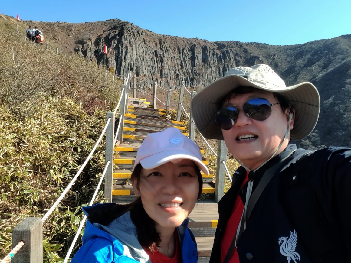
Still more steps to climb before reaching the top of the ridge. The Yeongsil and 500 Disciples Rock Formation could be seen in the backgound.

One of the rewards for hiking up Hallasan is the views. Yeongsil trail offers almost 360 degree views of the surrounding. Looking down, we could see many small cone-shaped hills scattered at the foot of Hallasan Mountain. These are volcanic cones and are called "oreum" in the Jeju dialect. They are formed from lava deposits discharged following a volcanic eruption.

There are 368 oreums scattered across Jeju Island. An excellent view of the oreums was seen from the slope of Mount Hallasan.


Interesting rock formation that looked like a sitting woman.

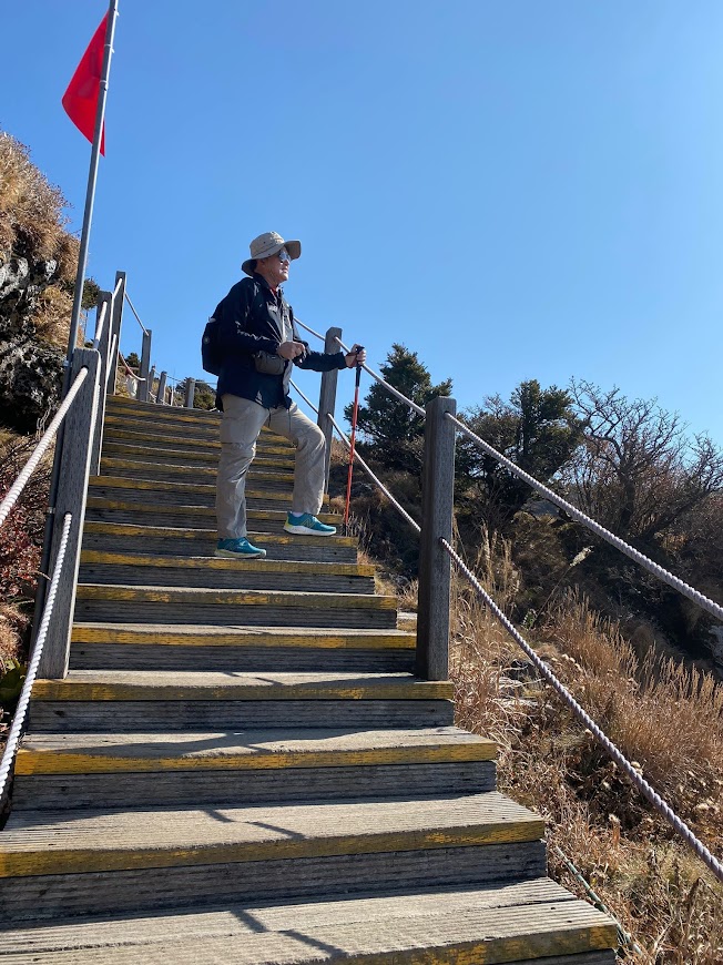
Nearing the end of the “stairway to heaven”.
Taking a moment to enjoy the views.
After completing the grueling “stairway to heaven”, the trail flattens out.
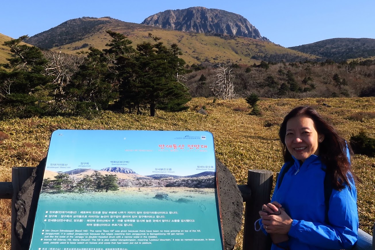
First sight of Baengnokdam, the crater summit of Hallasan.
This was the one of the nicer part of the trail leading to our destination, Witse Oreum. It was also quite windy and cold at this plateau in autumn.
The vegetation also changed from shrubs to that of grassland. We were actually walking through the Seonjakjiwal Plain which means “a field with small standing stones”.

Come at the right season, this place will be covered with colourful flowers.
It was about 12.30 PM when we arrived at Witse Oreum Shelter. We took 2.5 hours to cover the 3.7 km from the start point, with elevation gain of 420 metres.
At 1700m ASL, the air was much cooler and windy here. Temperature was probably around 10 degree C and it was good that we brought fleece jacket.

Having a rest and eating an onigiri rice cake at Witse Oreum while waiting for the rest of the group to arrive.

Signposts like these are found along the colour-coded trail.
We decided to have our picnic lunch inside the shelter at this site. The shelter is basic but nice and warm compared to the outdoors. There is a toilet at the shelter but no piped water. There is no food or drinks on sale along the trail, so hikers have to bring their own food and drinks.

Picnic lunch inside Witse Oreum shelter.
Lunch was hard boiled eggs and sandwich with sliced cheese, salad and ham. These were items that we bought the night before, at the E-mart next to our hotel. Some of my travelling companions even brought thermos flask with hot coffee. For me and my wife, we just drank our Gatorade.
We started down the north-facing Eorimok Trail at about 1.50 PM. The first part of the Eorimok trail was a easy, gradual descend. It was very similar to the last part of the Yeongsil trail.

Looking back, we could see Baengnokdam, the crater summit of Hallasan.
My wife and I were slightly ahead of the rest of my group so we took a slight detour to check out a viewpoint.

Viewpoint and rest area along the Eorimok Trail.
There are binoculars that allowed me to take a closer look of Jeju City in the distance.


Rest of my group hiking along the Eorimok Trail.
The trail soon became more difficult, strewn with rough lava rocks that could easily resulted in a sprained ankle if one is not careful or did not have proper footwear.

It may be easier to just walk on the grass outside the rocky trail.
For people in my age group, descending is probably more difficult than ascending. Some of the folks in my group were already feeling the effects of the hike. Some felt pain in feet and some felt pain in their knees.
The scenery along the Eorimok was not as nice as the Yeongsil trail. However, there were still plenty of nature and views to appreciate.

Fields of silver eulalia reeds could be seen at some places.
As we entered into the difficult part (red zone) of the trail, the trail became even steeper and more uneven.
Everyone went at their own pace and hence, our group was soon split. I personally felt it was easier to go at a steady pace downhill instead of stopping for a long rest. My legs would turn to jelly if I was to rest for too long.
We were now going through forested area. By November, there were plenty of brown oak leaves on the ground and the trees were almost bare.

Mid-point of the difficult part of the Eorimok trail.

Rocky part of the Eorimok trail. Hiking sticks helped a lot when descending.

It was about 4.30 PM when we spotted the bridge that indicated to us that we had arrived at the foot of the mountain. In autumn, there was no stream and only large boulders were seen in the riverbed.

Sight of red maple trees is our reward for reaching the end (almost!) of the Eorimok trail.

We took a rest at the bridge and also a few photos of the autumn colours.

There was still a short distance to go before reaching the car park where our driver was waiting for us.
Poor Mr. Won. He had been waiting for us since 3.30 PM and was worried for us since we were way behind schedule and the sun was setting.

It was almost 5 PM when we arrived at the trailhead of the Eorimok trail. The sun is soon setting!
The trailhead at Eorimok is at 970 metres ASL. We took 4 hours to hike down the 4.7 km trail with an elevation drop of 730 metres. This was longer than expected.
I find Eorimok Trail more difficult to negotiate due to the rough rocky surface and uneven steps. On hindsight, we should have ascended via Eorimok and descended via Yeongsil since it would easier on our legs and knees.

Celebrating the completion of our Hallasan hike with a group photo at the Eorimok carpark.
I am glad that everyone completed the hike. Some said “my legs almost gave way”. Perseverance and mental strength made up for our lack of physical strength and we kept going.
I am sure some time in the future, we will look back on this day and remember that we had come to Jeju and completed a hike up and down the slopes of Hallasan, enjoyed good times with good company.
Time to reward ourselves with a nice dinner after a day of physical activity. Next up is Jeju’s famous Black Pork BBQ.


No comments:
Post a Comment